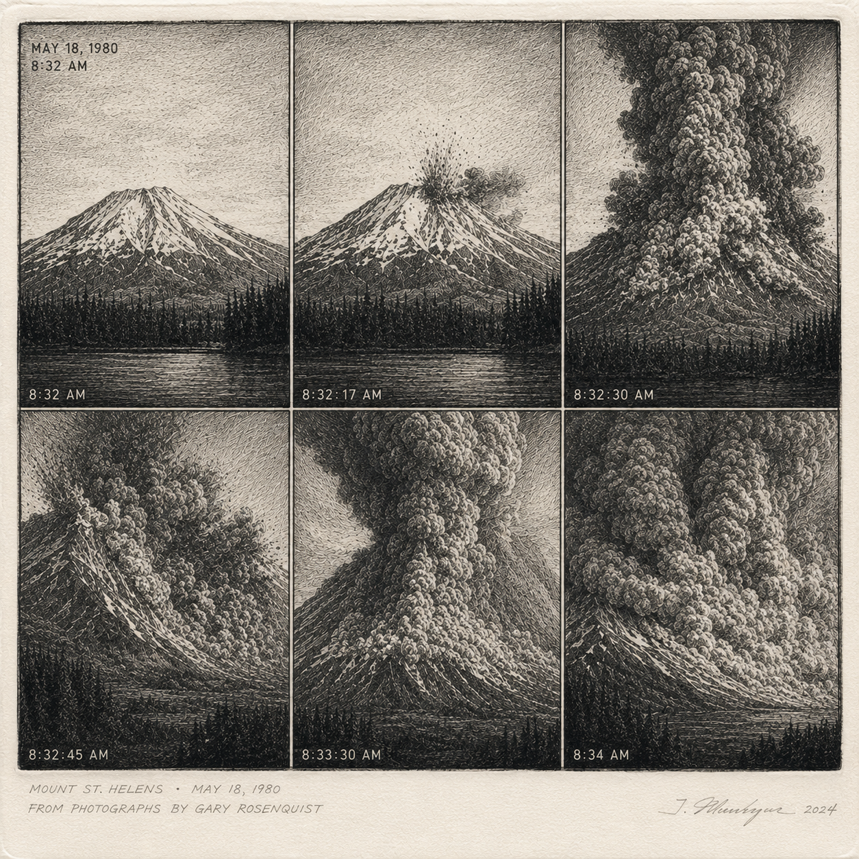
Ka-Boom!
May 18, 1980 – For two months leading up to this day, moderate earthquakes had been rattling the area around Mount St. Helens in Washington state. Steam vents had opened on the mountain, and a massive bulge was growing on its north slope. At 8:32 AM on May 18th, a magnitude 5.1 earthquake triggered a colossal landslide that exposed highly pressurized magma beneath the surface. Moments later, the volcano unleashed one of the most powerful eruptions in United States history.
More than a cubic mile of rock and debris blasted into the sky, leaving behind a gigantic horseshoe-shaped crater. The eruption released energy roughly equivalent to 1,600 Hiroshima-sized atomic bombs. The mountain lost about 1,300 feet of elevation. Fifty-seven people were killed, along with hundreds of thousands of animals.
One survivor was photographer Gary Rosenquist, who was camped about 11 miles from the summit. Just before the eruption, one of his fellow campers looked through a pair of binoculars and remarked that the mountain appeared "fuzzy." Rosenquist immediately began taking photographs, capturing a remarkable sequence of images that documented the catastrophic eruption as it unfolded.